


* China's ongoing second scientific expedition and research project on the Qinghai-Xizang Plateau has produced a series of high-standard original findings.* The expedition team has established a classification system for the Qinghai-Xizang Plateau ecosystem based on the integration of remote-sensing technology and ground surveys.* The Qinghai-Xizang Plateau ecosystem absorbs approximately 120 to 140 million tonnes of carbon dioxide (CO2) annually, accounting for 10 to 16 percent of China's total ecosystem carbon sink.
LHASA, Aug. 18 (Xinhua) -- China's ongoing second scientific expedition and research project on the Qinghai-Xizang Plateau has produced a series of high-standard original findings, providing scientific support for the ecological security of the plateau, according to the expedition's top researcher.
To date, the scientific research has yielded significant progress, including results of studies on the changes and impacts of the plateau's water and glacier resources, carbon sink functions and potential, ecosystems, and biodiversity changes, said Yao Tandong, an academician at the Chinese Academy of Sciences (CAS) and the leader of the scientific expedition, at a press conference held in Lhasa on Sunday.
The Qinghai-Xizang Plateau, known as the "roof of the world" and Asia's "water tower," is China's most crucial ecological security barrier and a strategic resource reserve, playing a vital role in water, ecological, climate and environmental security globally.
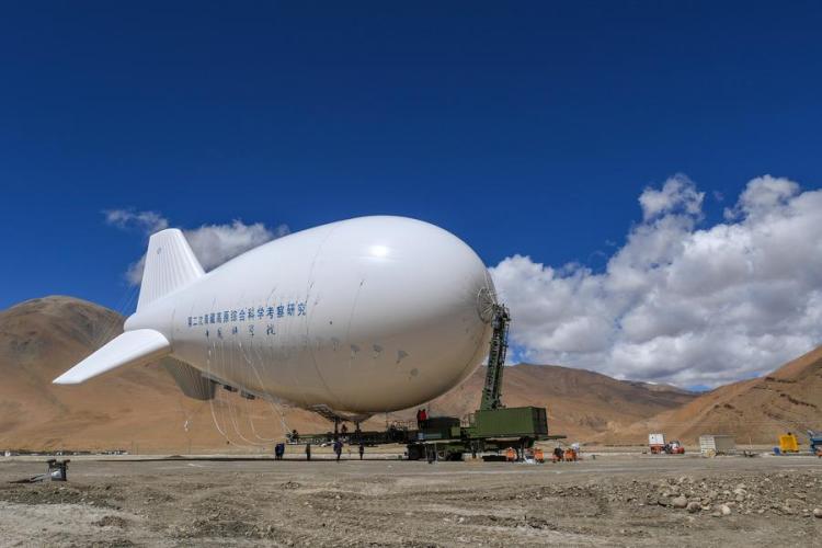
Since the scientific expedition was launched in August 2017, teams comprising more than 7,000 researchers have continuously conducted comprehensive surveys across 19 key areas.
CHANGES IN WATER RESOURCES
The Qinghai-Xizang Plateau is becoming warmer, wetter and greener, according to Yao.
"The glaciers and snow cover on the plateau are decreasing, while the vegetation is greening," he said. "Such changes could lead to significant shifts in the Asian monsoon circulation, potentially increasing the frequency of extreme weather events in China."
In recent years, the warming climate and increased humidity have led to significant imbalances on the Qinghai-Xizang Plateau, which have primarily manifested in the rapid reduction of solid water bodies such as glaciers and snow, alongside a widespread increase in liquid water bodies like lakes and rivers, resulting in a solid-liquid phase imbalance, Yao explained.
This scientific expedition and research project has revealed that the current total surface water storage of Asia's "water tower" exceeds 10 trillion cubic meters -- roughly equivalent to the total runoff of the Yellow River over 200 years.
Climate models predict that by the end of the 21st century, some regions could lose more than half of their glacier mass, with lake water levels potentially rising by over 10 meters, according to the conference.
While this phenomenon could enhance the overall water supply capacity, the risks of glacier collapses and glacial lake outburst floods are projected to be more than three times higher than current levels.
Yao also emphasized that the future water resources downstream of Asia's "water tower" require regionally differentiated strategies and comprehensive international coordination. "It is essential to strengthen the construction of early warning systems for glacial collapses and glacial lake outbursts, and to implement more effective measures for sustainable water resource management."
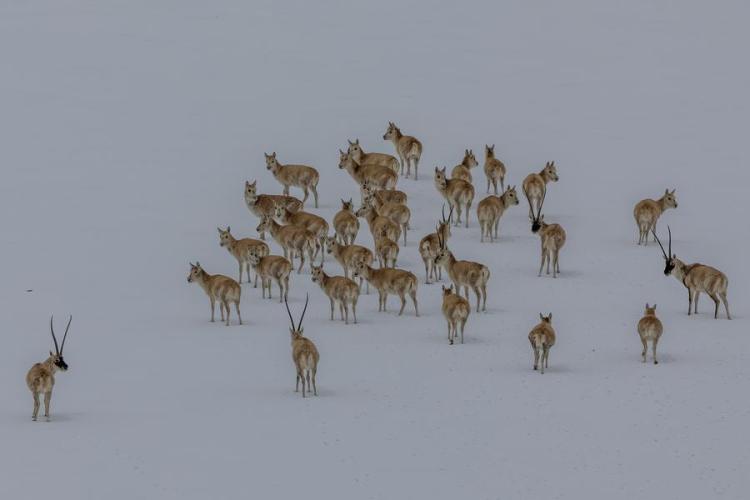
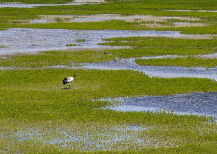
ECOSYSTEM, BIODIVERSITY ASSESSMENT
The expedition team has established a classification system for the Qinghai-Xizang Plateau ecosystem based on the integration of remote-sensing technology and ground surveys, contributing greatly to the analysis of changes in the ecosystem and biodiversity of the plateau.
Researchers have completed a 1:500,000 grassland vegetation map, a 1:500,000 soil map of the plateau, and a distribution map of the alpine tree line spanning 2,400 kilometers across the Himalayas.
"These maps reveal the spatial pattern and dynamic changes of the ecosystem, and improve our assessment of ecosystem quality and its service functions," said Ouyang Zhiyun, a researcher at the Research Center for Eco-Environmental Sciences under CAS.
The maps also support the formulation of biodiversity conservation strategies and the overall layout planning for national parks on the Qinghai-Xizang Plateau.
The expedition team has also conducted extensive field investigations in vulnerable and critical areas on the plateau, leading to a series of new discoveries in biodiversity. It has published its findings of over 3,000 new species, including 205 new animal species, 388 new plant species and 2,593 new microbial species.
The local government in southwest China's Xizang Autonomous Region has designated over 600,000 square kilometers of its land as ecological conservation red lines, accounting for more than 50 percent of the region's total land area.
Xizang has 47 nature reserves of various types and levels, covering a total area of 412,200 square kilometers. Its area of ecologically functional land, including forests, grasslands, wetlands and water bodies, has increased to 1.08 million square kilometers.
CARBON SINK FUNCTION
The Qinghai-Xizang Plateau ecosystem absorbs approximately 120 to 140 million tonnes of carbon dioxide (CO2) annually, accounting for 10 to 16 percent of China's total ecosystem carbon sink, according to findings released at the conference.
Given that the plateau currently emits 55 million tonnes of CO2 annually, its carbon surplus exceeds 65 million tonnes per year, Yao said.
Yao noted that the plateau's 1.4 million square kilometers of permafrost holds around 37 billion tonnes of organic carbon, accounting for over 60 percent of the plateau's total soil carbon stock.
"However, the potential thawing of deep permafrost due to future climate warming could pose a risk to its carbon sequestration capacity," he said.
The Global Observation-based System for Monitoring Greenhouse Gas (GONGGA) system, developed independently by the scientific research survey team, is an essential tool for estimating natural carbon sinks.
It integrates atmospheric transport modeling, CO2 concentration observations and CO2 emission inventories to accurately assess the carbon sink capacity of the Qinghai-Xizang Plateau ecosystem.
This system not only supports China's "dual carbon" goals with important scientific data, but also provides valuable Chinese data and methodologies for international carbon accounting and assessment.
"Going forward, the carbon sink function of the plateau can be enhanced by improving the quality of grassland and forest ecosystems," Yao said.
INTERNATIONAL COOPERATION
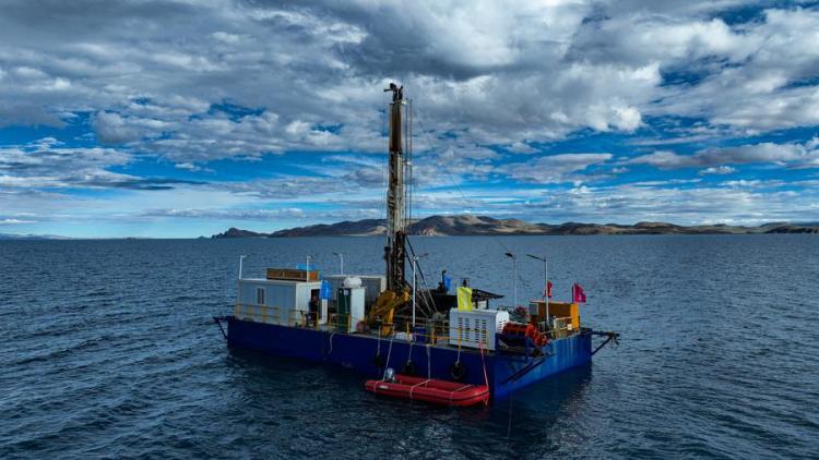
From early June this year, a joint scientific expedition team consisting of researchers from the CAS Institute of Tibetan Plateau Research (ITP), along with scientists and drilling experts from Germany, Switzerland, the United Kingdom and the United States, has conducted scientific investigations at Namtso Lake.
The team will carry out long core drilling in the lake to provide new scientific evidence for the study of climate and environmental changes on the Qinghai-Xizang Plateau over the past million years.
According to Zhu Liping, leader of the joint scientific expedition team and a researcher at ITP, the drilling of the lake sediment core in Namtso Lake is the highest-altitude drilling project under the International Continental Scientific Drilling Program.
Rolf Kipfer, a professor of environmental physics and aquatic science from Switzerland, is focusing on studying the formation of sediments and their relationship to the lake during this scientific expedition.
"I will analyze the physical structure of the lake and its water quality," Kipfer said, adding that this cooperation is a once-in-a-lifetime experience.
In 2009, Yao teamed up with Lonnie Thompson, a foreign academician at CAS, and Volker Mosbrugger, an academician at the German National Academy of Sciences, to launch the Third Pole Environment International Program.
With the aim of strengthening collaboration with international organizations, this initiative has helped enhance the international impact of the second Qinghai-Xizang Plateau scientific expedition and research project, and propel related research to the forefront of global scientific endeavors.
(Reporting by Zhang Dan, Shen Feng, Quan Xiaoshu, Lin Jianyang, Bai Shaobo and Liu Zhoupeng; Video reporters: Wu Sisi and Sonam Dekyi; Video editors: Zhang Nan, Li Qin and Li Ziwei.)